Warning: imagejpeg() [function.imagejpeg]: Unable to open '/var/www/joomla/images/resized/images/stories/articles/niku/lidar_nord-norge_100_70.jpg' for writing: No such file or directory in /var/www/joomla/plugins/content/contentmap.php on line 659
Technological Advances in Landscape and Heritage Management Recording - ArcLand one day symposium
 |
|  |
| 
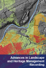
Organised by Rob Sands and Steve Davis, UCD School of Archaeology and sponsored by the UCD Humanities Institute of Ireland, this one day ArchaeoLandscapes Europe symposium focused on the increasing use of technology in the recording of archaeological sites, monuments and landscapes.The event also provided the opportunity for Archaeolandscape to be introduced to a new audience and as a result new affiliate members were signed up to the project.
The venue was full with over 40 people attending. Attendees included members of archaeological organisations, the general public and students from both Ireland and other parts of Europe. Feedback from the day was extremely positive, many people commenting that for a day of technical discussion the presentations were both informative and enjoyable. We hope to make many of the presentations that we given on the day available for viewing.
Further information, including abstracts, can be found on the symposium web site. Links to speakers organisation and the programme can be found below.
Speakers
- Keith Challis, GIS and remote sensing, Visual And Spatial Technology Centre, Birmingham, England
- Anthony Corns, Discovery Programme, Ireland
- Dr Steve Davis, UCD School of Archaeology, Ireland
- Rory McNeary, Environmental Sciences Research Institute, University of Ulster, Northern Ireland
- Dr Axel Posluschny - Project Manager, ArchaeoLandscapes Europe, Germany
- Dr Rob Sands, UCD School of Archaeology, Ireland
- Rob Shaw, Discovery Programme, Ireland
- Dr David Strange-Walker, Manager, The Nottingham Caves Project, England
- Dr Lyn Wilson, Project Manager, The Scottish Ten, Scotland
- Dr Žiga Kokalj, Institute of Anthropological and Spatial Studies, Slovenia
Programme
|
Welcome |
Rob Sands |
|
ArchaeoLandscapes Europe - Supporting Remote Sensing Methods as a Tool for Archaeological Research and Cultural Heritage Protection of Europe |
Axel Posluschny |
|
Spatial Data sharing within Cultural Heritage |
Anthony Corns |
|
DEM visualization techniques for archaeological interpretation |
Žiga Kokalj |
|
Unknown, virtually: The Nottingham Caves Survey |
David Strange-Walker |
|
The Scottish Ten: 3D Digital Documentation of Global Heritage Sites |
Lyn Wilson |
|
Lasers, Landscape and Muddy Boots. Potential Applications for Immersive Visualisation of Airborne Lidar |
Keith Challis |
|
Techniques for recording underwater and terrestrial cultural environments: some examples from the Centre for Maritime Archaeology, University of Ulster |
Rory McNeary |
|
Fish Tales and lasers: mud, wood, tides and challenges |
Rob Sands |
|
High Resolution LiDAR: modelling the micro-topography of iconic archaeological landscapes in Ireland |
Rob Shaw |
|
Talking about a revolution? LiDAR and landscape in the Boyne Valley and beyond |
Steve Davis |
|
Close of Symposium |
Rob Sands |
( 0 Votes )

