Outreach
3rd Aerial Archaeology Training School in Merida (Spain) | |  | | 
Download preinscription form here Dates18-23 June 2012 Organized by
Aimed atStudents and graduates in archaeology or related fields. Number of places20 maximum Inscription fee300 euro GrantsArchaeolandscapes Europe offers 5 grants of up to 500 euro to support students with no extra funding. More information here. Merida Institute of Archaeology offers up to 9 free accommodation grants. Please apply in the preinscription form. Important dates
Acceptance will be based on a process of evaluation of the applications received during the pre-inscription period. A short statement and a CV will be required. ObjectivesIntroducing the basics of aerial imaging for archaeology, through a combination of short theoretical presentations and supervised practical seminars. The students will explore different interpretive and technical procedures, such as: photo reading and interpretation, georreferencing and rectification, data integration, GIS analysis, integration of aerial images with ground based techniques or data capture in the field with low altitude remote control devices. Programme: thematic blocks
OrganizersCésar Parcero-Oubiña, Institute of Heritage Sciences (Incipit), Spanish National Research Council (CSIC). (Archaeolandscapes Europe partner) Cristina Corsi, University of Evora & Frank Vermeulen, University of Ghent. (Radio Past partners) Victorino Mayoral & Enrique Cerrillo, Mérida Institute of Archaeology (IAM), Spanish National Research Council (CSIC) Teaching expertsArchaeolandscapes Europe
Radio Past Project
Mérida Institute of Archaeology
Other
Download preinscription form here ( 0 Votes ) Add new comment
Last Updated (Friday, 13 January 2012 13:53) Small exhibitions | |
Smaller exhibitions, funded by individual partners as part of their own work within the project, will be displayed at a variety of venues, from local museums and libraries to shopping malls or other public spaces. Moreover, all project partners will be encouraged to undertake ‘public outreach’ initiatives along these lines, including arranging public meetings, giving talks or contributing posters at academic and other conferences, as well as creating digital content in the national language for their own websites and/or for the central website of the ArchaeoLandscapes project.
( 3 Votes ) Last Updated (Tuesday, 06 September 2011 18:02) |
Training and Research on the Archaeological Interpretation of Lidar: TRAIL 2011 | |
An international three-day workshop on archaeological interpretation of lidar data was held in mid-March at the European Archaeological Centre at Bibracte. It was organized in cooperation with the LEA ModeLTER (MSHE C.N. Ledoux, ZRC SAZU), ArchaeoLandscapes Europe, ISA and the AARG. More than 60 researchers working with lidar data in archaeology participated. The workshop facilitated discussion, helped share expertise and supported collaborations within this growing research community. The event was organized in three parts:
PresentationsTopics included the practicalities and experiences of and opportunities for working with lidar in France (L. Nuninger, M. Leroy) and other parts of Europe (R. Opitz, S. Crutchly, Ž. Kokalj). Case studies focused on methodological development (K. Challis), presented successes and possible pitfalls (C. Fruchart, M. Leroy), and illustrated practical (B. Štular, N. Poirier) and theoretical (D. Mlekuž) approaches to integration of lidar data into the wider scope of landscape archaeology. WorkshopsSmall group workshops provided an opportunity to gain practical, hands-on experience in a number of areas. In addition to a beginner’s course, workshops were held on the topics of
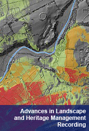
These workshops aimed to combine exercises and discussion. Participants were provided with access to a variety of software tools and sample datasets, and many participants brought data which they are currently using in their projects. Each participant was able to attend two or three workshops. Round table discussionA round table discussion (moderated by A. Posluschny and Ž. Kokalj) at the end of the meeting on the state of the field and the potential for future collaborative research raised a number of interesting points and questions – the two most important being on the issue of management of large new data volumes and the significance of pushing the technology and methods past the prospection phase. Discussion on the topic of large scale prospection – as illustrated by the work of Ralf Hesse who has mapped more than 100,000 features in past few years in Baden-Württemberg, Germany – combined enthusiasm with the recognition of major challenges. It was remarked that the use of lidar data in archaeology can be seen as a "third revolution" following after the aerial photography and high-resolution satellite imagery, while it was agreed that the increasing popularity and effectiveness of lidar as a prospection method is creating a serious challenge: how should we manage the masses of newly gathered data? This challenge is particularly acute as another recognized trend is the increasing availability of free or inexpensive "second hand" lidar data; some European countries are in the process of national acquisition campaigns, e.g. the Netherlands, Denmark, England, Czech Republic and Slovenia. The conviction that more archaeologists should be involved in the lidar data interpretation process was the main result of the discussion on this topic. To harness this enormous potential of these emerging datasets, it is suggested that methods should to be developed that will enable archaeologists to engage with lidar derived data with minimal training.( 0 Votes ) Last Updated (Friday, 09 December 2011 11:03) Technological Advances in Landscape and Heritage Management Recording - ArcLand one day symposium | |
Organised by Rob Sands and Steve Davis, UCD School of Archaeology and sponsored by the UCD Humanities Institute of Ireland, this one day ArchaeoLandscapes Europe symposium focused on the increasing use of technology in the recording of archaeological sites, monuments and landscapes.The event also provided the opportunity for Archaeolandscape to be introduced to a new audience and as a result new affiliate members were signed up to the project. The venue was full with over 40 people attending. Attendees included members of archaeological organisations, the general public and students from both Ireland and other parts of Europe. Feedback from the day was extremely positive, many people commenting that for a day of technical discussion the presentations were both informative and enjoyable. We hope to make many of the presentations that we given on the day available for viewing.
Further information, including abstracts, can be found on the symposium web site. Links to speakers organisation and the programme can be found below.
Speakers
Programme
( 0 Votes ) |