GreekEspañolNederlandsRomânăEnglish
Login
Close


  • Forgot your password?
  • Forgot your username?
  • Home
  • About
    • Aims
    • Work Package
    • GMB
    • Funding
    • Previous projects
    • Partners
    • Contact Us
    • ArcLand resources
  • News & Events
    • News
    • Events Calendar
    • World News
  • Capture
    • Aerial Photography
    • UAV & Kites
    • lidar
    • Satellite
    • Geophysics
  • Interpret
    • Interpret & Mapping
    • Cropmarks
    • Soilmarks
    • Topography
    • Hyperspectral
    • Geophysical
    • Landscape Change
    • GIS Integration
  • Outreach
    • Archives
    • Archive Survey
    • Training Schools
    • Workshops
    • Exchange visits
    • Teaching
    • Sharing Data
    • Publications
    • Exhibitions
    • Conferences
    • Grants
    • Guides & Best Practice
    • Tools
  • Case Studies
    • Aerial Imagery
    • Geophysics
    • Lidar
    • Multi-Spectral
    • Integrated Research
  • Resources
    • Web Links
    • Documents
    • Image Gallery
    • Forum
    • Sitemap
    • Tags
    • Terms and Conditions
    • Privacy Policy
    • Search
    • Tools
linkedin_button

Join Us


Follow ArcLand on Twitter
Follow Us


Like us on Facebook
Like Us
photo_survey_button
Latest News
  • EU has accepted 7 new Associated Partners
  • ArcLand accepted as EAA Working Party!
  • Lidar Visualisation Toolbox goes Open Source
  • LiDAR Toolbox LiVT 1.0.0.19
  • LiDAR-Toolbox available
  • Booklet "DAI weltweit" available for download
Events
Thu Sep 26
30th Annual AARG Conference
View Full Calendar
Popular Tags
aerial photograph aerial survey archaeology digital surface model digital terrain model dtm interpretation landscape lidar lidar survey mapping micro topography photo reading remote sensing topographic survey

Welcome to the homepage of the EC funded project "ArchaeoLandscapes Europe" (ArcLand). Explore how aerial imagery and remote sensing is being used by archaeologists to understand our past.

The webpages will be updated with new content on the ArcLand project and on archaeological prospection in general during the life-span of the project, so please keep us book-marked and feel free to send us your comments and suggestions! You can also follow our activities on Facebook.


capture

Capture

Explore the different technologies used to record archaeological features on and below the ground surface

interpret

Interpret

Understand the methodologies used to identify and interpret archaeological features within remotely sensed data

outreach

Outreach

Find out how to take part in activities to advance the sharing and understanding of remote sensing within archaeology

workpackage

Work Package

Description of the ArchaeoLandscapes project activities and deliverables


Recent Articles

DART Heritage Remote Sensing Horizon Scanning Workshop 17 July 2013, 15.16
DART Heritage Remote Sensing Horizon Scanning Workshop
DART Heritage Remote Sensing Horizon Scanning Workshop School of Computing, University of Leeds, United Kingdom Tuesday, September 17, 2013 from 9:30 AM
Read More 0 Comments 337 Hits 0 Ratings
The Past for the Present – new methods of the study of the history of Polish-Byelorussian borderland 10 July 2013, 14.09
The Past for the Present – new methods of the study of the history of Polish-Byelorussian borderland
Date: July 29th- August 9th, 2013 Place: Supraśl (Poland) Aim: The main aim of the workshop is to promote the understanding of new methods in
Read More 0 Comments 372 Hits 0 Ratings
Workshop report: "LiDAR - innovative technology for archaeology" 03 July 2013, 12.06
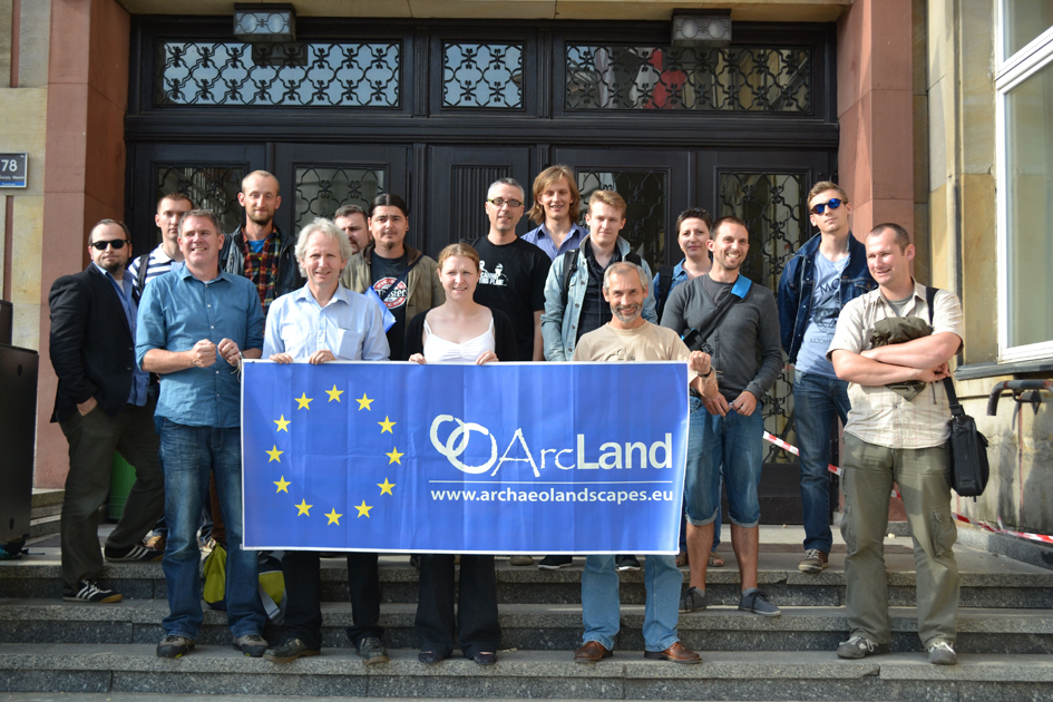
Workshop report:
The ArcLand workshop and training school "LiDAR - innovative technology for archaeology", organised by the Adam Mickiewicz University Poznań,
Read More 0 Comments 519 Hits 0 Ratings
2D-3D-4D… DIY Workshop – Digital Landscape “on demand” 26 June 2013, 18.04
2D-3D-4D… DIY Workshop – Digital Landscape “on demand”
Are you wondering what’s next in Digital Aerial Archaeology? Do you agree there is much more in a JPG than “just” cropmarks or soilmarks? Do you
Read More 0 Comments 1543 Hits 5 Ratings
Aerial Archive Survey 2013 21 June 2013, 13.47
Aerial Archive Survey 2013
Create your free online surveys with SurveyMonkey , the world's leading questionnaire
Read More 0 Comments 624 Hits 0 Ratings
Aerial photographic archives – some preliminary results from an online survey 10 June 2013, 13.33
Introduction – WP 5 One of the eight work packages (WP) or key actions in the ArcLand project is Securing better exploitation of existing air-photo
Read More 0 Comments 818 Hits 5 Ratings
International Summer School "Drones Applied to Cultural Heritage and Archaeology" 05 June 2013, 10.20
International Summer School
International Summer School "Drones Applied to Cultural Heritage and Archaeology" 20-26 September 2013, Pontignano (Siena), Italy The Summer School
Read More 0 Comments 1271 Hits 0 Ratings
Kite Archaeology 16 May 2013, 08.44
Kite Archaeology
under construction - content will be provided
Read More 0 Comments 1355 Hits 0 Ratings
Copyright © 2013 . All Rights Reserved.
About ArcLand Contact Us Privacy Policy Terms & Conditions

Creative Commons Licence